If you want a great variety of day hikes with spectacular views you can't go past Lake Tekapo. Set in the McKenzie Country of the South Island, surrounded by mountains, Lake Tekapo offers some of the most jaw-dropping scenery. Many of these walks are easy to get to as a tourist. I've focused this blog on the six hikes I did in summer while on a five day stay here.
Lake Tekapo is a spot for all seasons. Lupin flowers flourish in early summer, the mountains are snow capped in spring, winter brings low lying snowy landscapes, and golden foliage in autumn. There seems to be no bad time of year to visit.
These walks are between 45 minutes to 3 hours, and range from easy to harder (but not tough.) Personally if I find a steep hill is getting tough and I'm struggling, I simply stop, have a drink and look at the view.
The short walks are free, easy to get to, don't require bookings and offer incredible views of the lake and surrounding mountain ranges.
I've ordered these walks from easiest to hardest.
This article contains one affiliate link. If you decide to purchase from this link you'll get a 10% discount and I get a commission. This helps me to keep creating helpful free content. I only recommend gear I use and love.
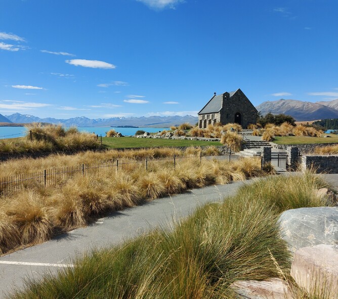
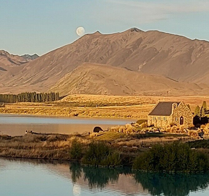
The iconic Church of The Good Shepherd, Lake Tekapo.
1. Lake Tekapo foreshore walkway - flat & easy.
This is the most accessible walkway in Tekapo. It's straight out in front of the main shops on the lake edge. You can access the walk from anywhere between the Tekapo Springs complex on the west end of the walkway down to the Church of the Good Shepherd.
The walk is flat and easy. It's 3km (1.9 miles) long and takes around 45 minutes one way. That doesn't take into account stopping for multiple photos along the way.
At the Lake Tekapo Domain you can explore the built-to-scale model of the solar system. A great interactive activity for every age.
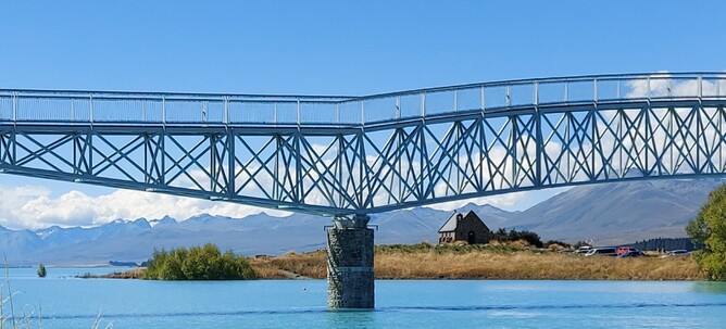
The footbridge between the domain and The Church of the Good Shepherd is a great photo spot - but to be honest, the whole track is a photographers dream.
The McLaren Footbridge links The Church of the Good Shepherd and the lakefront domain.
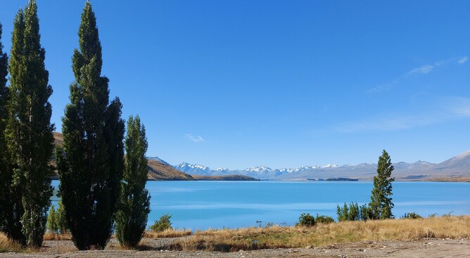
The lakefront views are breathe-taking.
2. Pines Beach walkway - flat & easy.
The gentle walk to Pines Beach continues east passed the Church of the Good Shepherd. The trail takes you around the lake edge offering more views of the town and surrounding hills from the eastern side of the lake.
It's a 45 minute walk one way, or 1 hour 30 return. I'm a fan of return hikes because you see the views from a different angle coming back.
You could also hire a bike and combine this walk and the Foreshore walk for an easy bikeride.
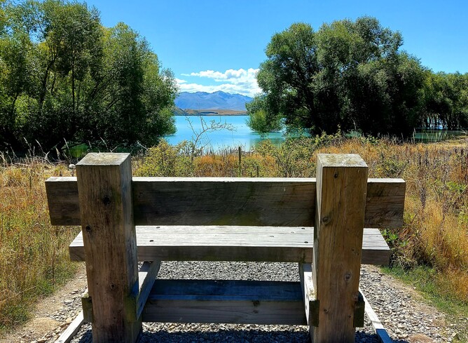
Many of the walkways have beautifully positioned resting spots.
3. Cowan's Hill walkway - relatively easy with gentle inclines.
Cowan's Hill walkway starts on the eastern end of the bridge leading into the township.
This walk takes 1 hr 30 min and it's inclines are not challenging. This walk gives big bang for your effort. It was my absolute favourite walk because it's so close to town, not too arduous and a lovely change in scenery.
Walking above the river affords beautiful views looking back to the lake. The walk goes through pine forests in varying stages of growth. Some afford nice cool walking conditions, but where the trees have been milled, new views have appeared. This will be a changing landscape for years to come.
When you reach the peak of Cowan's Hill you get a 360 degree view of the McKenzie Basin and the lake and mountains.
From the top you continue down the track and into more forests. You could take a side walk to Pines Beach.
Another alternative to descend, is at the top of Cowan's Hill you can walk towards the lake on a track heading towards the new housing area. There are sign posts through the subdivision, pointing you to the main road.
Cross the main road carefully and then join the lake track at the bottom.
I loved this walk so much I did it twice.
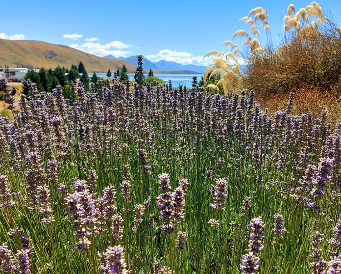
Lavender & local gardens along the start of Cowan's Hill track.
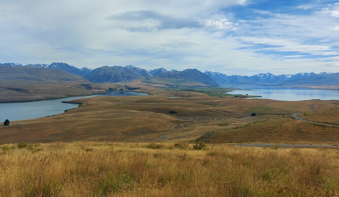
At the top of Cowan's Hill are expansive views of the McKenzie Basin and big sky country.
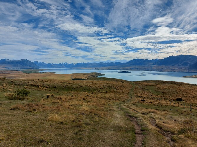
4. Peninsula Walkway - mostly easy with some rougher terrain areas..
The Peninsula Walkway is 7km out of town, so you'll need to organise a ride. This loop walk offers more stunning views of Lake Tekapo, but a bit further up the lake.
It's 5.6km (3.5 miles) and takes about 1.5 - 2 hours. It's closed around lambing season - mid October to mid December.
It's an exposed spot so if it's chilly take extra layers, and in summer take water and cover up.
The views are once again incredible and there are a number of spots where seats provide a gorgeous spot to sit and take it all in.
Lake & mountain views from the tip of the Peninsular Walkway.
5. Mt John Summit walk - steep in parts with steps - good heart pumping walk..
The Mt John Summit walk starts just before the Tekapo Springs and Spa complex at the western end of town. It's 2.8km (1.7 miles) up hill, so a return trip of 5.6km (3.4 miles).
The first part is a rough, gravel road. The walk then enters the larch forest and is a steady incline generally, with a few steeper parts in places. It's refreshing and cool under the trees on a hot summers day.
At the top you come out to open grassland where the steps give your calves a good workout. You are rewarded with incredible views of the lake and mountains.
You can walk around the circuit at the top for more expansive views. There is a cafe at the top - Astro Cafe - but at the time of writing this it was closed due to the pandemic. But when it opens, I think you'll agree it would easily win, " the cafe with the best view" award.
Mt John also has night sky observatories on it (see the next section for details).
You could walk back down the track you came up, or go down via the Lake Shore Walkway. The views on this track while descending were phenomenal.
Plenty of photo opportunities as I catch my breath at the top of Mt John.
Aoraki McKenzie Dark Sky Reserve.
The area surrounding Tekapo is a Dark Sky reserve. Simply walking down to the foreshore and looking up is incredible.
At the top of Mt John you'll see the buildings of the University of Canterbury's Mt John Observatory.
There are companies that do star gazing tours and one of the telescopes is used for that purpose. There is a road up to the observatory if you decide to take a tour. I didn't take a tour as it was full moon and it's not the best time to examine the night sky.
Can you spot the Southern Cross?
6. Lake Shore Walkway - flat then steep. Really gets the heart pumping!
The Lake Shore walkway is an alternative route up or down to Mt John. The lake shore section is easy, but once you start going up, it gets a lot harder.
It's 6.3km (3.9 miles) and takes 1 hour 45 minutes to walk up. It's fairly steep in parts. Sometimes the lake level is too high and the lower lake track is submerged, so check at the information centre.
You can either walk back the way you came or walk down the Mt John Summit track.
The views on this walk are superb. I walked along this walkway up to Mt John. It's hot and exposed to the sun, so carry water with you. I stopped often for a breather and to take photos of the views. It was incredible.
I then took the Summit Track down. Walking up the Lake Shore walkway and down the Summit Track took me 3 hours - including breaks and photo stops.
There is a toilet at the top behind the temporarily closed cafe.
I was lost for words up here on the Lake Shore walkway up to Mt John.
How did I manage all these walks as a light traveller?
I walked these hikes in mid February where day temperatures were around 23C (73F). We have strong UV light here so sun protection is essential.
Using my waist bag from my Idea Mountain bag (I am an affiliate) I was able to carry sunscreen, a small water bottle, plasters, my asthma inhaler and my phone. I find this bag handy as my cross body bag gets in the way when hiking.
I wore a merino tee shirt, with a long sleeve merino top tied round my waist with my neck buff tied in, neither of which I needed. I wore shorts, socks and my barefoot walking shoes. I find I don't need big hiking boots for my style of walking. I generally walk for up to four hours, fairly well formed tracks. Although there were some pretty rough surfaces to walk on here. I also don't need ankle support. Trail shoes is another lighter option.
I could easily hand wash my clothes at night if I needed to, but really it was only the shorts that weren't merino that needed it.
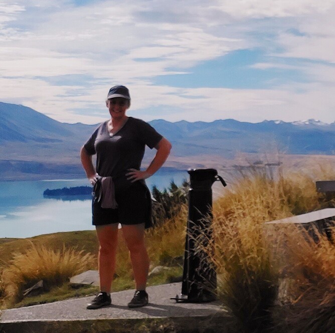
Feeling good after a good hike up to the summit of Mt John.
Hiking in Lake Tekapo for solo travellers.
Since I am occasionally a solo female traveller I always let someone know where I'm going and when I'm back. It's as simple as a text saying, "I'm off to the Mt John Summit track." Followed by, "home now". It gives me reassurance that if anything happens someone will know the area I should be in.
I ask at local information centres if there are areas known not to be safe for solo female hikers. The hikes I did around Lake Tekapo were deemed very safe.
As with any hiking, I always recommend you:
- Carry a basic first aid kit, water, and layers of clothing - the weather can change very quickly in New Zealand.
- Check the weather forecast and be prepared to change plans.
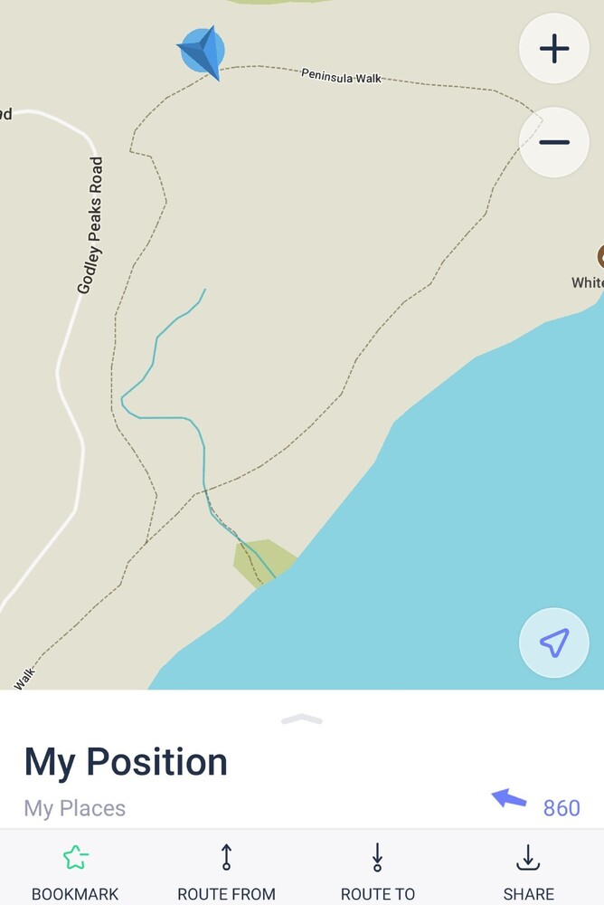
- Have a map, or a map app on your phone that works offline - I use maps.me (I'm not an affiliate) It's a clever app that can show you the elevations of your walk, expected walking times, and shows you where you are on the map. I've been using the basic settings of the app for 5 years now. Make sure you download the region you're going to before you leave home as it uses a lot of data when downloading the regional map.
The offline Maps.me app gives me security knowing where I am - the blue triangle shows my location.
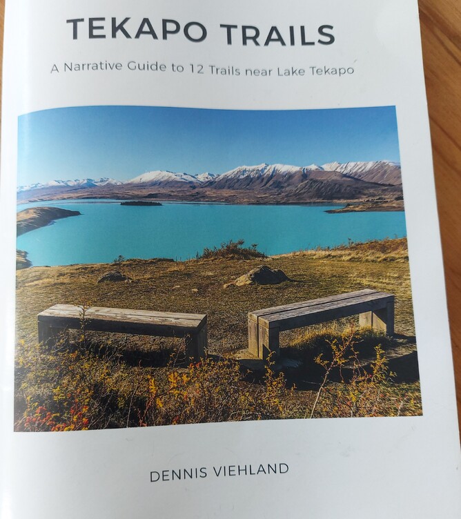
Great to find a helpful guidebook by a local hiker in my accommodation.
I thoroughly recommend hiking around Lake Tekapo.
Many people drive through Tekapo, take a picture of the church, and head on to their next destination. Lake Tekapo has so much more to offer for such a small but growing town.
Biking, hiking, spa treatments, good cafes, bars and restaurants. There are lots of water activities on offer, and of course skiing in winter. Allow yourself to spend at least one night here to see the night sky and more of what Tekapo has to show off.
I'll leave you with one last photo I took as the full moon was rising over the Church of The Good Shepherd.
PS This post was featured by Twinkl among their list of Great Walks of New Zealand. (Not affiliated - just sharing cool stuff).
